MONTEREY HARBOR
OPERATIONS AND MAINTENANCE
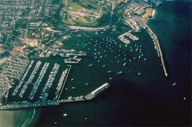
PROJECT LOCATION AND DESCRIPTION
The project is located in Monterey Harbor, California, which is approximately 100 miles south of San Francisco. This project consists of a 1,700 foot long west breakwater and an 8–foot-deep Mean Lower Low Water (MLLW) basin near Municipal Wharf No. 1 (Fisherman's Wharf).
|
TOTAL FUNDING:
|
|
|
TOTAL COST:
|
N/A
|
|
FEDERAL COST:
|
N/A
|
|
NON-FEDERAL COST:
|
N/A
|
|
|
|
|
TOTAL FEDERAL COST THROUGH FY 2022
|
$134,000
|
|
FY 2023 BUDGET:
|
$0
|
|
COST TO COMPLETE:
|
N/A
|
FY 22 accomplishments
- In-house labor to complete geospatial land data migration into the Corps map system.
- Perform periodic inspection of the project to monitor structural conditions.
- Perform Vertical Datums
FY 23 accomplishments
- In-house labor to complete geospatial land data migration into the Corps map system.
- Perform periodic inspection of the project to monitor structural conditions.
- Perform Vertical Datums
ISSUES AND OTHER INFORMATION
- The City of Monterey is the Non-Federal Sponsor (NFS).
- The west breakwater was constructed in 1934.
- Following years of gradual settlement, the breakwater crest was restored to its original design elevation in FY 93. This effort provided improved benefits to the original project by reducing harbor facility maintenance, vessel damage, and navigation delays.
- The Corps dredged the basin near Wharf No. 1 periodically between 1947 and 1957.
- Since 1957, the City has removed insignificant quantities of material without Federal assistance.
- SPN annually inspects the jetty and has determined that minor repairs are needed.
CONGRESSIONAL INTEREST
- 19th District, Rep. Jimmy Panetta
POINT OF CONTACT
- Deputy for Project Management, (415) 503-6593.
Updated on 14 February 2023

Click Map to Zoom In