 UPPER GUADALUPE RIVER FLOOD RISK MANAGEMENT REFORMULATION STUDY
San Jose, California
*************************************************************
In accordance with the National Environmental Policy Act (NEPA) of 1969, the U.S. Army Corps of Engineers San Francisco District has prepared a draft General Reevaluation Report/Supplemental Environmental Assessment (GRR/EA) for the proposed Upper Guadalupe Flood Risk Management Project, located in San Jose, California. The GRR/EA was prepared in collaboration with Valley Water. The GRR/EA assesses alternatives for proposed flood risk management in San Jose between the Union Pacific Railroad Bridge and Blossom Hill Road and analyzes potential environmental effects that could result from those alternatives. USACE held a public comment period on the draft GRR/EA from Nov. 7, 2022 to Dec. 16, 2022. A public meeting to review the document and update the public on the status of the project was held in San Jose on December 8, 2022, where input was also invited. The team is in the process of responding to technical, policy, public, and agency review comments. A Final GRR/EA which incorporates feedback received will be released in Winter 2024.
Upper Guadalupe River Flood Risk Management Reformulation Study - Draft General Reevaluation Report and Supplemental Environmental Assessment [PDF]
* The public comment period has closed and a Final Report which addresses comments received will be released in the Winter of 2024. To contact the study team, you may email UpperGuadalupe@usace.army.mil or mail Mr. Jeneya Fertel, 450 Golden Gate Ave, 4th Floor, San Francisco, CA 94102. Thank you for your input!
PROJECT LOCATION AND DESCRIPTION (see project map)
The Upper Guadalupe River Flood Risk Management Project is a General Reevaluation Study, or Reformulation for flood risk management in San Jose, California. This project was in construction for the previously authorized plan with two mitigation reaches completed; however, issues encountered during design necessitated a General Reevaluation. General Reevaluation Studies are feasibility studies that are conducted to affirm, reformulate or modify an authorized plan, or portions of a plan, under current planning criteria. The San Francisco District of the U.S. Army Corps of Engineers is conducting this study, in partnership with the Santa Clara Valley Water District (Valley Water), who is serving as the non-federal sponsor.
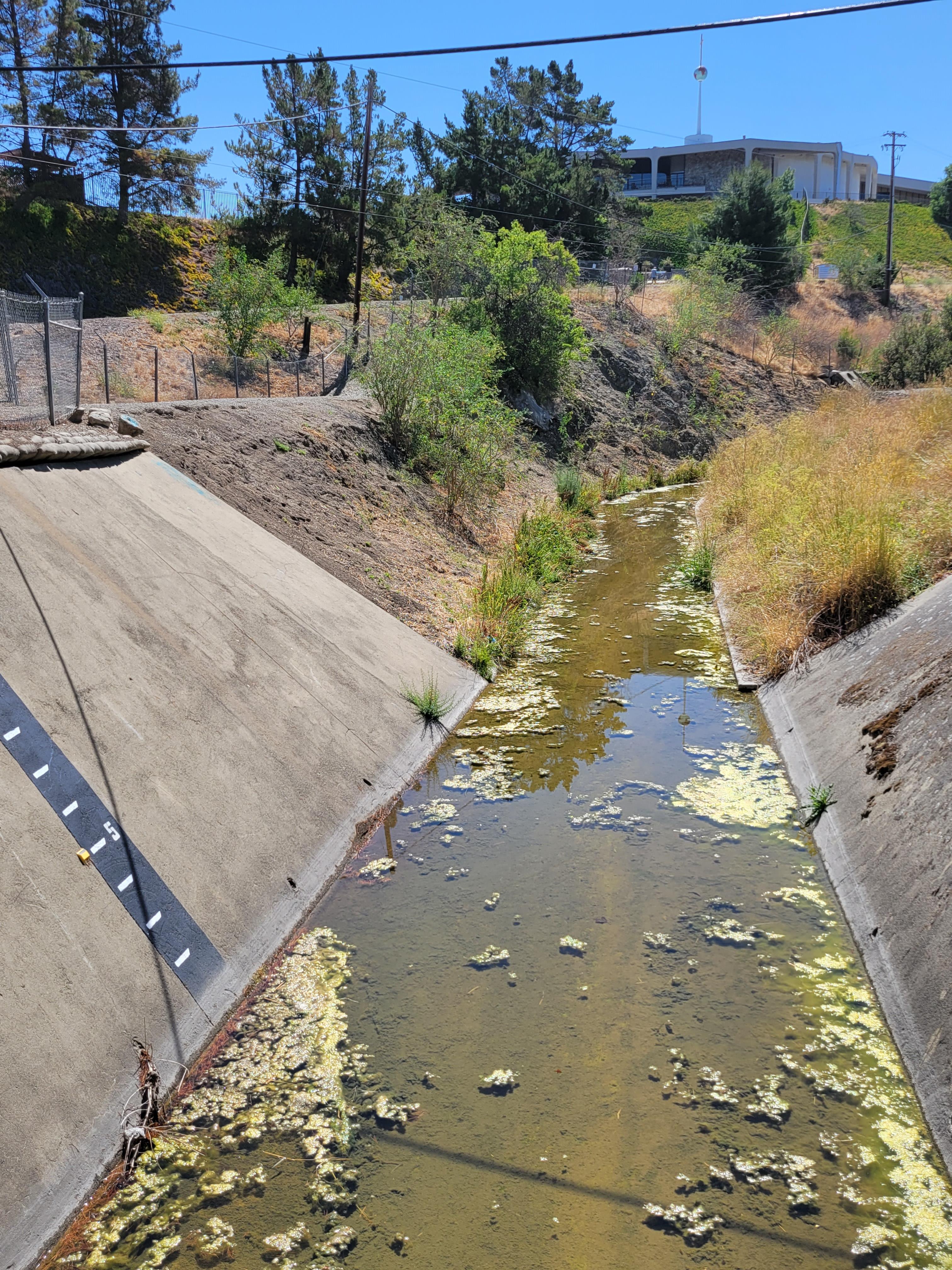
The primary authorized purposes are flood risk management and recreation improvements along the Upper Guadalupe River and its tributaries in San Jose, Santa Clara County, California. This project begins at Interstate Highway 280, at the edge of downtown San Jose, and extends south for approximately 5.5 miles, upstream from the constructed Downtown Guadalupe River Project. The tentatively selected plan (TSP) utilizes a combination of floodplain bench creation, floodwalls along Ross and Canoas Creeks (tributaries to the Upper Guadalupe River) and culvert/bridge replacements/rehabilitations to reduce the risk of flood damages while incidentally improving protected salmonid species habitat. In this way, the TSP “engineers with nature” to manage flood risk in a way that also improves environmental quality, where feasible.
More information on the TSP and the analysis to date can be found in the Draft General Reevaluation Report and Supplemental Environmental Assessment which can be found below. USACE and Valley Water heard from you after initiating a request for comments that ended Friday, Dec. 16, 2022. Comments can be sent at any time during the study and will be considered; however, comments received during the comment period will receive written responses in the Final Report. The Final Report, incorporating feasibility level design, will be released in Winter 2024 once all comments have been addressed and incorporated, as appropriate, and the recommendation has been finalized.
The TSP saves roughly $350 million dollars, compared with the previously authorized plan, yet delivers comparable benefits and added environmental quality when compared to the previously authorized plan. The TSP costs roughly $152.8 million and provides $15.1 million in annual net benefits, delivering $21.6 million in average annual total benefits to the national economy. These benefits are mostly due to flood damages avoided. Additionally, the TSP will provide $59 million in gross regional products, 554 jobs, and $83.9 million in regional economic output.
The TSP has significant environmental justice benefits, serving socially vulnerable flooding impact areas that currently experience hazardous flood risk, as well as affluent parts of the study area at risk for more shallow flooding.
Finally, this plan would increase riparian forest habitat, and increase both aquatic rearing habitat, and salmonid spawning habitat through the creation of floodplain benches. Agriculture and development in the Santa Clara Valley have eliminated most of the riparian forest in the region. The riparian forest along the Guadalupe River and nearby creeks constitutes the last remaining areas of significant riparian forest in the valley. Along the Upper Guadalupe River, remaining riparian habitat has been reduced and degraded by channelization, gravel mining, and development. This project converts parking lots and pavement to riparian forests and reestablishes a previously urbanized floodplain. Riparian forests are among the most productive habitats for wildlife in California, providing food sources and shelter for fish and wildlife. These habitats support the most dense and diverse wildlife communities in the Santa Clara Valley, with generally the highest levels of biodiversity.
GENERAL RE-EVALUATION REPORT FUNDING
| TOTAL COST* |
$3,000,000 |
| FEDERAL COST |
$1,500,000 |
| NON-FEDERAL COST |
$1,500,000 |
* USACE is seeking a waiver to exceed $3 million for the study. Waiver request is for an additional $2.27 million, to be cost-shared 50/50 with Valley Water.
GENERAL RE-EVALUATION REPORT FY21 & FY22 ACCOMPLISHMENTS:
- USACE and the Non-Federal Sponsor (NFS) signed a Feasibility Cost Share Agreement (FCSA) in December 2020.
- The project team identified potential alternatives to meet the study purpose and a focused array of alternatives to evaluate for potential project implementation in April 2021.
- The team has updated hydrologic and hydraulic modeling of the Upper Guadalupe River system, updated associated economic analyses, coordinated with the environmental resource agencies, held public meetings, and coordinated with other local stakeholders.
- The Tentatively Selected Plan was identified in August 2022, and received concurrence from the vertical team.
- The project team plans to release the Draft General Re-evaluation Report/ Supplemental Environmental Assessment in November 2022.
PUBLIC INVOLVEMENT GENERAL RE-EVALUATION REPORT
- USACE and Valley Water have sought public input through three public meetings: A virtual scoping meeting in July 2021 and hybrid meetings in August and December of 2022.
- A Draft General Re-evaluation Report/Environmental Assessment (Draft Report) was prepared and released in early November for public comment.
GENERAL RE-EVALUATION SCHEDULE TO COMPLETE / WAY FORWARD (Assumes cost and schedule exemption request is approved.)
| * Public and Agency Comment Period on the Draft report |
Nov. 7 - Dec. 14, 2022 |
| * Response to Comments/Feasibility Level Design and Optimization of the Recommended Plan |
Nov 2022 - Summer 2023 |
| * Release Final Report |
Summer/Fall 2024 |
| * Chief's Report |
End of 2024 |
| * Pre-Construction Engineering and Design Phase for New Recommended Plan Begins (pending authorization and funding) |
2025 |
| * Project is Construction (pending authorization and funding) |
2026 - 2033 |
FY 20 AND FY 21 ACCOMPLISHMENTS (CONSTRUCTION)
- Complete O&M Manual for turnover of Reaches 10B & 12 to non-Federal Sponsor (NFS).
- Revisit plans for Reaches 7 & 8 due to excessively high velocities and determine new approach.
- Complete total project cost summary and benefit-cost ratio update for Construction Project.
TOTAL CONSTRUCTION FUNDING (Previously Authorized construction paused for ongoing re-evaluation)
| TOTAL COST |
$297,000,000 |
| FEDERAL COST |
$192,000,000 |
| NON-FEDERAL COST |
$105,000,000 |
| TOTAL FEDERAL COST THRU FY 2020 |
$26,500,000 |
| FY 2021 BUDGET |
$0 |
| COST TO COMPLETE |
$0 |
ISSUES AND OTHER INFORMATION ON THE PAUSED CONSTRUCTION PROJECT
PAST REPORTS
CONGRESSIONAL INTEREST
- 16th District, Rep. Anna Eshoo
- 17th District, Rep. Ro Khanna
- 19th District, Rep. Jimmy Panetta
POINT OF CONTACT
- Deputy for Project Management, (415) 503-6593.
Updated on 16 May 2023
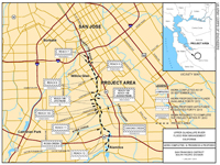
Click Map to Zoom In